
The Mpumalanga Policy Discussion Map serves as a platform to foster dialogue surrounding critical considerations for a Just Energy Transition within the province, particularly within the energy sector. The map offers two primary functionalities:
- Policy insights: Policy makers can utilize the map to visually assess regions most affected by the Just Energy Transition by selecting specific layer features pertaining to the carbon economy.
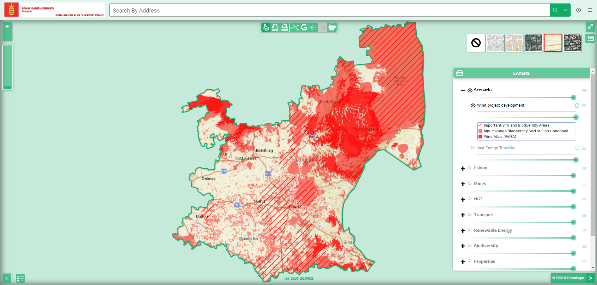
- Renewable energy pre-assessment: Renewable energy companies can conduct initial evaluations of potential development sites by selecting layer features relevant to project implementation.
Pre-defined scenarios tailored to these use-cases are provided, though the map remains accessible to the public for diverse applications. Users are encouraged to review the terms of use and manual, available for download below. The development of this map was made possible through collaboration with the Danish Embassy Pretoria. For guidance on navigating the map’s functionalities, please refer to the accompanying user
guide below.
GENERAL DISCLAIMER
By accessing and using the content of this map and website in what so ever manner, you acknowledge and agree to the General terms of use. This can be downloaded below.
ESSENTIAL LINKS
GIS database from Department of Forestry, Fisheries and the Environment (DFFE): Access here
Wind Atlas South Africa (WASA): Access here
Environmental Screening Tool from the DFFE: Access here
Eskom’s Generation Connection Capacity map: Access here
Bird Life South Africa’s best practice guides for wind and solar PV projects: Access here
Eskom’s Transmission Development Plans: Access here
Mpumalanga Biodiversity Sector Plan (MBSP): Access here
InvestSA’s Energy-One-Stop-Shop: Access here